 |
| At the Tikwalus Trail Head |
Around us the cedars towered so high their tops were lost in the canopy that blocked the midday sun. We sat in the coolness on a bench constructed from logs. In front of us an information sign had been posted detailing the history of this portion of the trail. The "Lake House" it read, once the site of a cabin that had been used as a resting stop for gold miners trekking through the Fraser Canyon in search of their fortunes. Up on the rise across the little stream was a level spot with a pile of stones at one end. This was the place where the cabin had stood and the stones were remnants of a fireplace. Who would think to put a cabin here in such a remote a spot? In those days I suppose all these places were remote, This one maybe not so much, situated on what was a major route in 1858 and a good source of water about a 100m away in a small lake, hence the name. The story also told of a native girl who had seen her spirit bear around here. A white bear that emerged from the forest and vanished. She tried to follow it but did not see it again. This place is eerie, steeped in history, a sacred place to natives but ancient even before they discovered it.
 |
| The Chief Pahallak Viewpoint |
Behind us the trail stretched back about 4km to the Trans Canada Highway, not far from the old Alexandra Lodge. The trail goes up a few stairs and then crosses a nice footbridge that had been built by the
Hope Mountain Centre volunteers. From there it rises steeply into the forest. Information signs along the way offer a reason to stop periodically and get your breath back.
Carrying a 38 pound backpack for our overnight stay at the campsite at the top of the hill was probably not anywhere near what the HBC men or the gold miners had to endure as they hauled their supplies over the mountains, but it does give you a pretty good appreciation of what they must have gone through. Relentlessly up and up, the section between Km 2 and KM 3 seemed the worst. Once we got past the Lake House the uphill sections were still there but they were a little more gradual comparatively with a few short steep sections.
 |
| A junction in the forest. We went via the Lakes Route |
 |
| Info Sign At The Lake House Stop |
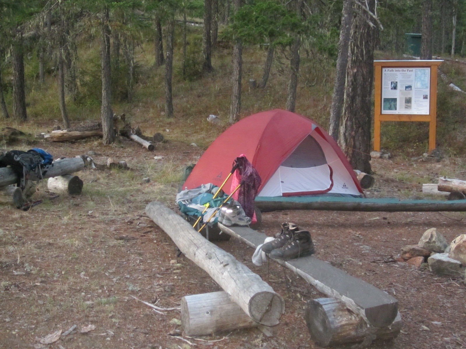
We arrived at the camp site at about 5:30pm. The brochure I had read said we would be near a lake which we could use for drinking water. My illusions of jumping into a nice cool mountain lake after a hot sweaty hike were dashed right away when the sign at the camp informed us that the lake was in fact about 7 minutes back down the Bluffs Trail. The trail is a loop. We had decided to take what was called the Lakes Route to the camp site. To complete the loop you leave the camp site and head back toward the trail head on the Bluffs Route. The lake proved to be a little tough to get to. We had to climb over a bit of deadfall and then work our way around the rocks on the other side. There I found a spot good enough to throw my water filter in and pump out a few litres of water for the night. The water was a little green but the filter seemed to do the trick alright.
 |
| Site of the Lake House |
The campsite is set up with an outhouse, a picnic table and food cache locker situated well away from the camping area. There is also a fire pit beside the picnic table you could use for cooking and also a larger fire pit down at the campsite for socializing at night. Unfortunately there was a campfire ban on for BC while we were there so we had to forgo the pleasure of a fire and instead sat talking by the light of the moon and our headlamps.
I had my usual poor sleep when I'm camping and I drifted in and out of sleep as the sounds of the highway and railroads made their way to us in our remote camp at the top of the hill, a reminder that civilization was not too far away.
The next morning we decided to continue north along the Bluffs route although the map says this part of the trail is unmaintained. We decided to try it anyway as it would intersect another historic trail called the 17 Mile Creek Mule Trail, part of the 1858 Gold Rush Trail. This would get us back to the highway and only be about 2.5km as opposed to hiking the 6km back to the Tikwalus trail head.
 |
| Enjoying the view at the campsite at the end of the day |
 |
| Camp is set |
There were some fantastic views along the Bluffs Trail and the trail was not too bad at all. It had been flagged and was pretty obvious on the ground. There were a few places where trees had fallen across the trail but nothing too significant. It lead into the bush again and on the trees were some old wooden markers showing that we had reached the 1858 trail. From here it was a steep descent back down to the highway, zig-zagging through the forest and along the creek.The trail here was marked by flag tape, tree markers and it had been cleared by chainsaws at one point or two but that was a few years ago now by the looks of it.
 |
| The view in the morning |
 |
| The Fraser Canyon and Trans Canada Hiway from the Bluffs Trail |
 |
| Older signs like this still aid in route finding |
Closing thoughts:
- If you do decide to hike it as a loop, take a few minutes before you head back to go up the Bluffs Trail to the north about half a kilometre. You will see some amazing views of the Fraser Canyon.
- We did not do the Bluffs route as part of the Tikwalus loop so I cannot say much about it.
- The Lakes Route offers more history boards so that is why we chose it. The Culturally Modified Cedars offer some interesting information.
- Make sure to take a water filter for the lake water at the camp site.
- There are few other sources of water on the way up at the time of year we went (August). There is a lake at the Lake House stop.
- A fire would be nice to have at night but as I said, there was a fire ban on at the time.
- The Hope Mountain Centre and volunteers did an excellent job setting up this trail and campsite. I'm not sure what their future plans are but it would be nice to see the Bluffs route to the 17 Mile Creek Mule Trail improved a little and the 17 Mile Creek trail itself cleaned up. The access point if you were to look for the trail head by the highway is virtually invisible!
These trails offer an interesting way to experience the history of the Fraser Valley. You are walking in the same footsteps of people who were there over a hundred and fifty years ago. It is great that these trails are being preserved and rediscovered.
*Note: This post is a document on my journey on this trail and should not be used as a guide. Before hiking this trail make sure you are well equipped and informed!
 |
| From the campsite in the morning |
 |
| Morning over the Fraser Canyon |
 |
| Info sign at the campsite |
 |
| Summit Selfie! |


No comments:
Post a Comment